A map of Amelia Island shows a barrier island off the northeast corner of Florida, about thirteen miles long and two miles wide at its widest, running north to south between the Atlantic Ocean on the east and the Amelia River and marsh on the west. Fernandina Beach sits on the north end, and Fort Clinch guards the very top where the island meets the mouth of the St. Marys River and the Georgia line. That sentence is most of what you need. The rest of this is the part the map quietly declines to mention.
Start with the one line every map draws and then assumes you understand: the bridge. There is really only the one main way on and off by car, the A1A bridge from Yulee on the mainland in Nassau County. Worth knowing before you plan to dash off the island in a hurry on a Friday in July.
What does a map of Amelia Island actually show?
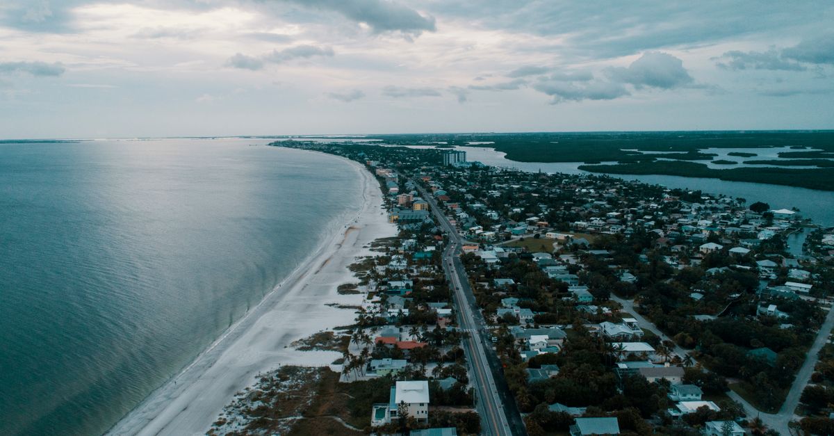
A map shows a thirteen-mile barrier island oriented north to south, with the Atlantic along the entire eastern edge and the Amelia River and salt marsh along the west. The east side reads as one long unbroken strand of beach. The west side reads as a ragged, fingered border, and that border is the part people misjudge.
That western edge is not coastline in any tidy sense. It is salt marsh, and it breathes. At low tide it is a flat of pluff mud and oyster rakes that will take a shoe right off your foot and keep it as a souvenir. At high tide it is water, and a creek the map labeled as a thin blue thread is suddenly wide enough to lose a kayak in. A map prints one version of that edge. The marsh keeps two and changes its mind on a schedule.
The dark green blocks are the maritime forest: live oaks bent low and bearded with Spanish moss, slash pine, and palmetto thick enough underneath that you will not be cutting through it for a shortcut. Egans Creek Greenway is the big green wedge near the north end, a few hundred acres of that wild stuff threaded with trails, with alligators and roseate spoonbills included at no extra charge.
What is the nicest part of Amelia Island?
It depends on whether you want a town or a retreat. The north end, around Fernandina Beach, is the walkable old port town. The south end is the resort end of gated communities and golf laid into the dunes. The middle stretch of A1A is the part nobody fights over. Both ends are nice the way a porch and a parlor are both nice, which is to say not the same and not for the same afternoon.
Fernandina Beach is the old port town: a fifty-block historic district of Victorian houses, a working shrimp dock, and Centre Street running straight from the river to the ocean side. It is the part of the island with a downtown you can walk, which on a barrier island is no small thing. It is also the only incorporated city on the island, so when a map shows you "city limits," it is talking about Fernandina Beach and not much else.
The south end is the resort end, with golf, the kind of place built so you never quite have to leave it. The map will show you both and let you find out the hard way which one fits you, which is the only way anybody ever really learns it.
Here is the short version of what the map labels and what each part is:
| Part of the island | What the map shows | What you actually get |
|---|---|---|
| North end (Fernandina Beach) | The only "city limits" on the island | Walkable historic downtown, shrimp dock, Centre Street |
| South end | Gated communities and golf | A self-contained resort stretch |
| Middle (along A1A) | A thin road line | The quieter in-between most visitors skip |
| Northern tip | A green rectangle with a fort icon | Fort Clinch State Park and the channel views |
What is the most beautiful beach on Amelia Island?
The whole east side is one long beach, but a few stretches earn the word. Fort Clinch State Park at the northern tip has the quiet dune-walk beaches, where the water opens onto the channel and Cumberland Sound, so you see the ocean, the river, and Georgia's Cumberland Island across the way in one view. Main Beach near Fernandina is the busy one with parking and easy access. Peters Point and American Beach are wider and emptier.
American Beach deserves a name said plainly. It was founded in 1935 by Abraham Lincoln Lewis, the first president of the Afro-American Life Insurance Company, and it is listed on the National Register of Historic Places as a recognized historic site. NaNa, the big dune that anchors it, is one of the tallest on the island. A map will give you a dot and a label. It will not give you that history, and a person ought to know it before they spread a towel.
What is special about Amelia Island?
The island has flown eight different flags over its history, the line you will hear before your bags are out of the car. French, Spanish, English, the so-called Patriots, the Green Cross of Florida, Mexican rebels, the Confederacy, and the United States all took a turn. For a sandbar two miles wide, that is a busy résumé.
What the map shows you instead is the practical specialness. There is the deepwater port and the shrimping fleet, with Fernandina Beach holding a fair claim to being a birthplace of the modern shrimping industry. There is Fort Clinch, a brick fort the Army never finished but kept building anyway, the way some people keep a project going long after the reason for it has wandered off. And there is the plain geographic fact that the island runs north-south, so the sun comes up over the Atlantic on the east side and sets over the marsh on the west. You can watch both from the same island without driving an hour, a thing the Gulf coast cannot say.
Who famous lives on Amelia Island?
The map will not tell you, and neither will I, because it prints street names and not residents. The gated south end is built precisely so you cannot tell who is behind the gate, and the people most likely to be behind it are the people least likely to want a name on a chart.
What I can tell you is the kind of place it is: quiet money, second homes, golf, and a stretch of coast far enough from the airport to discourage anyone who needs to be seen. If a place wanted to be famous for its famous people, it would not have built a maritime forest between itself and the road. Draw your own conclusion. The island already has.
How do you read an Amelia Island map like a local?
Stop reading the roads as the important lines. On a barrier island the lines that decide a property are the tide lines, the flood zones, the marsh edge that moves, and the gap between a lot on high ground under the oaks and one sitting low where the water remembers it used to go. The map draws two such lots the same size. A storm out of the Atlantic in September does not.
Two houses three streets apart can sit on different planets when that storm comes up. We spend a good deal of our days at Salt Harbor Real Estate walking properties that look identical on paper and turn out nothing alike on foot, which is the part of an island map that only your shoes will tell you. A chart is a fine place to start. It is a poor place to stop. The island, like the marsh, keeps a second version of itself, and it does not hand it over to anyone holding a phone sideways at the foot of the bridge.
Frequently asked questions
What is the nicest part of Amelia Island?
It depends on whether you want a town or a retreat. The north end around Fernandina Beach is the walkable old port town with a historic downtown, while the south end is the resort end of gated communities and golf. The middle stretch along A1A is the quieter in-between.
What is the most beautiful beach on Amelia Island?
The whole eastern side is one long Atlantic beach, but Fort Clinch State Park at the northern tip is the standout, with quiet dune-walk beaches and views of the channel, the river, and Cumberland Island. Main Beach near Fernandina is the busiest and most accessible, while Peters Point and American Beach are wider and emptier.
What is special about Amelia Island?
Amelia Island has flown eight different flags over its history and runs north to south, so you can watch the sun rise over the Atlantic and set over the marsh from the same island. It also has a deepwater port, a shrimping fleet, and Fort Clinch, a brick fort the Army never finished.
How long and wide is Amelia Island?
Amelia Island is a barrier island about thirteen miles long and roughly two miles wide at its widest point. It runs north to south off the northeast corner of Florida, with the Atlantic Ocean on the east and the Amelia River and salt marsh on the west.
How do you get to Amelia Island by car?
The main route by car is the A1A bridge from Yulee on the mainland, in Nassau County. There is essentially one primary way on and off the island by road, which is worth planning around during busy summer weekends.